Blog

  • A New Attempt to Explain the Accelerated Expansion of the Universe

    A New Attempt to Explain the Accelerated Expansion of the Universe

    Rethinking Cosmic Acceleration

    Why is the universe expanding at an ever-increasing rate? This question—one of the greatest mysteries in modern cosmology—has long puzzled scientists. Since observations in the late 1990s revealed that the universe’s expansion is accelerating, researchers have invoked the existence of a hypothetical form of energy known as “dark energy” to explain it. Yet, despite decades of investigation, the origin and nature of dark energy remain elusive.

    An international research team from the Center for Applied Space Technology and Microgravity (ZARM) at the University of Bremen (Germany) and the Transylvanian University of Brașov (Romania) has proposed a bold alternative:
    Perhaps the universe’s accelerated expansion can be explained—at least in part—without invoking dark energy at all.

    Beyond Einstein: A New Geometric Framework

    In conventional cosmology, the evolution of the universe is described by Einstein’s General Theory of Relativity (GR) and the Friedmann equations derived from it. However, when these equations are applied to the large-scale universe, they fail to account for the observed acceleration—unless a dark energy term is manually added.

    Unsatisfied with this artificial addition, the research team explored a deeper theoretical foundation. Their approach is based on an extension of general relativity known as Finsler gravity, which generalizes the concept of spacetime geometry itself.

    “The Finsler model allows for a more precise description of how gravitational forces interact with matter and radiation,” explains Christian Pfeifer, physicist at ZARM and co-author of the study. “It’s a broader geometric framework than Einstein’s spacetime, and this flexibility may hold the key to explaining cosmic acceleration naturally.”

    The Finsler-Friedmann Equations

    By extending the classical Friedmann equations into the Finsler geometry framework, the researchers derived what they call the Finsler-Friedmann equations. To their surprise, these new equations predict an accelerated expansion of the universe even in a vacuum, without the need for any external “dark energy” contribution.

    This result suggests that spacetime itself may inherently possess properties that drive acceleration—a profound shift in understanding the universe’s dynamics.

    “This is an exciting indication that we may be able to explain the accelerated expansion of the universe without dark energy,” says Pfeifer. “The new geometry opens up entirely new possibilities for understanding the fundamental laws governing the cosmos.”

    A Window into the Future of Cosmology

    While these results do not entirely rule out the existence of dark energy, they provide a compelling geometric alternative that could reshape the way scientists think about the fabric of the universe.
    The team’s findings, published in the Journal of Cosmology and Astroparticle Physics (JCAP), invite further exploration into how generalized spacetime geometries might explain other unresolved cosmological phenomena—such as dark matter effects or the early universe’s inflationary phase.

    Acknowledgements

    The authors and editors(By Birgit Kinkeldey, Zentrum für angewandte Raumfahrttechnologie und Mikrogravitation (ZARM)
    Edited by Lisa Lock, reviewed by Robert Egan) acknowledge the following organizations and contributors for their support and collaboration in communicating and expanding access to this research:

    • The Zentrum für angewandte Raumfahrttechnologie und Mikrogravitation (ZARM) at the University of Bremen, for theoretical and institutional leadership.

    • The Transylvanian University of Brașov (Romania) for joint mathematical modeling and cosmological simulations.

    • Dr. Christian Pfeifer (ZARM) and Dr. László Árpád Gergely for their pivotal roles in developing the Finsler-Friedmann theoretical framework.

    • The German Research Foundation (DFG) and the European Space Agency (ESA) for research funding and academic support.

    • The Journal of Cosmology and Astroparticle Physics (JCAP) is for the peer review and publication of the findings.

    Through its educational platform and outreach materials, DatalytIQs Academy continues to bridge the gap between advanced research and accessible learning for students and professionals worldwide.DatalytIQs Academy contributes to science education, public engagement, and interdisciplinary dissemination of frontier research in physics, cosmology, and data-driven innovation.

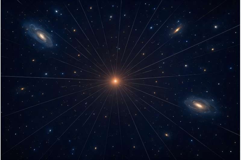
    Special appreciation goes to AI-assisted visualization contributors, including Christian Pfeifer and the ZARM visualization team, for producing the conceptual image of the universe’s Finsler expansion.

  • Software Solution Sharpens James Webb’s Eyes — No Astronauts Needed

    Software Solution Sharpens James Webb’s Eyes — No Astronauts Needed

    Two Ph.D. students, Louis Desdoigts and Max Charles, have achieved what once required a space mission: they restored the James Webb Space Telescope’s sharp focus using only software.

    Working under Professor Peter Tuthill (creator of JWST’s Aperture Masking Interferometer), the pair developed AMIGO (Aperture Masking Interferometry Generative Observations)—a neural network–based correction system that simulates JWST’s optics and detector behavior.

    Problem:
    The telescope’s infrared camera suffered from subtle electronic distortions — known as the “brighter-fatter effect” — that blurred images from its interferometer.

    Solution:
    AMIGO models these imperfections and applies AI-driven deblurring algorithms, restoring JWST’s interferometric precision without physical intervention.

    Results:

    • Sharper direct images of a faint exoplanet and a brown dwarf orbiting HD 206893 (≈133 light-years away).

    • Renewed captures of a black hole jet, Io’s volcanic surface, and WR 137’s dusty stellar winds.

    • Demonstration that AI calibration can extend the telescope’s capabilities from the ground.

    Why It Matters:
    This marks a new paradigm in space instrumentation—where machine learning can correct optical distortions remotely, ensuring multibillion-dollar telescopes remain in peak form without human missions.

    Dr. Desdoigts is now at Leiden University; Max Charles continues work at Sydney. Their work appears on arXiv and will soon be published in the Publications of the Astronomical Society of Australia.

  • Double Meteor Delight: Southern Delta Aquariids & Alpha Capricornids Light Up July Skies

    Double Meteor Delight: Southern Delta Aquariids & Alpha Capricornids Light Up July Skies

    Two Cosmic Streams, One Night of Wonder

    As July draws to a close, the night sky will host a celestial duet — two meteor showers, the Southern Delta Aquariids and the Alpha Capricornids, peaking together overnight on July 29–30, 2025.

    With the moon conveniently out of view, skywatchers across both hemispheres can expect up to 25 meteors per hour, glowing across dark skies in graceful streaks of cosmic dust.

    “It’s one of those rare nights when two showers blend into a single, mesmerizing display,” notes the American Meteor Society (AMS).

    The Southern Delta Aquariids: Trails from Comet 96P/Machholz

    The Southern Delta Aquariids (SDA) are the stronger of the two showers, originating from Comet 96P/Machholz, a 6-kilometer-wide comet discovered in 1986 that takes 5.3 years to orbit the Sun.

    • Active Period: July 18 – August 12

    • Peak Night: July 29–30

    • Meteor Rate: Up to 20 meteors per hour

    • Best Viewing: Pre-dawn hours, when Aquarius sits highest in the southern sky

    • Characteristic: Faint but lingering trails, often bluish-white

    Because their radiant — the apparent origin point — lies in the constellation Aquarius, observers in the Southern Hemisphere will have the best view. Those in the Northern Hemisphere should look low toward the southern horizon in the early morning hours.

    The Alpha Capricornids: Slow, Bright, and Colorful

    Complementing the Aquariids, the Alpha Capricornids (CAP) are fewer but often spectacular, producing bright, slow-moving meteors and occasional fireballs.

    • Active Period: July 7 – August 15

    • Peak: July 29–30

    • Meteor Rate: 5–10 per hour

    • Parent Body: Comet 169P/NEAT, discovered in 2002

    • Orbit Period: 4.2 years

    • Radiant: Constellation Capricornus, next to Aquarius

    Because their radiance is close together, meteors from both showers appear to emanate from the same area of sky, blending into one continuous celestial performance.

    “The Alpha Capricornids tend to be especially bright and colorful,” notes AMS, “so even if they’re fewer, they’re often more memorable.”

    How to Watch the 2025 Meteor Duo

    Meteor Shower Parent Comet Peak Dates Best Time Where to Look Meteors/hr Notes
    Southern Delta Aquariids 96P/Machholz July 29–30 Pre-dawn Southern sky (Aquarius) ~20 Faint, persistent trails
    Alpha Capricornids 169P/NEAT July 29–30 After midnight South-southeast (Capricornus) 5–10 Bright, colorful fireballs

    Viewing Tips:

    • Best Hours: Midnight to dawn (local time)

    • Moon Phase: Waning crescent — minimal interference

    • Optimal Locations: Southern Hemisphere or tropical latitudes

    • Equipment: None needed — use naked eyes for the widest field of view

    • Eye Adjustment: Allow 20 minutes in darkness for optimal sensitivity

    The Science of Shooting Stars

    Meteor showers occur when Earth passes through debris trails left behind by comets. As these particles collide with the atmosphere, they ignite from friction, creating glowing streaks visible for fractions of a second.

    Both the Machholz and NEAT comets are short-period comets, returning regularly and continually refreshing their debris fields. By studying these meteor streams, astronomers refine:

    • Orbital models of small-body dynamics,

    • Chemical composition of cometary dust, and

    • Interactions between Earth’s magnetosphere and meteoroid influx.

    Why It Matters

    This double meteor peak demonstrates how cosmic cycles intersect with predictable mathematical precision.
    At DatalytIQs Academy, it offers learners an opportunity to connect:

    • Orbital mechanics with observable sky events,

    • Data modeling (meteoroid flux per hour) with real-world observation, and

    • Astronomical storytelling with scientific understanding.

    It’s the perfect classroom moment to merge data, dynamics, and awe.

    Acknowledgments

    This analysis draws from Jamie Carter’s 2025 Live Science report, with data sourced from:

    • American Meteor Society (AMS) meteor stream database

    • NASA’s Center for Near-Earth Object Studies (CNEOS)

    • International Meteor Organization (IMO) observational data

    • ESA’s Space Situational Awareness (SSA) program

    Curated and interpreted by Collins Odhiambo Owino for DatalytIQs Academy – Astronomy & Space Analytics Series, connecting celestial events to scientific literacy.

  • Orionids 2025: Halley’s Comet Meteor Shower Peaks as Two New Comets Cross the Night Sky

    Orionids 2025: Halley’s Comet Meteor Shower Peaks as Two New Comets Cross the Night Sky

    A Celestial Symphony of Fire and Ice

    This October, the heavens will stage one of the most dazzling performances of the year — the Orionid meteor shower, produced by dust and debris from Halley’s Comet, will reach its 2025 peak on the nights of October 20–21.

    But that’s not all: two newly discovered visitors — Comet Lemmon (C/2025 A6) and Comet SWAN (C/2025 R2) — will be at their brightest almost simultaneously, making this a rare triple-comet spectacle under a moonless sky.

    According to the American Meteor Society (AMS), this year’s Orionids coincide with a new moon, meaning the darkened sky will offer exceptional viewing conditions for both meteors and comets — weather permitting.

    The Orionids: Halley’s Legacy Returns Every Year

    Every October, Earth passes through a trail of dust left behind by Halley’s Comet, which last visited the inner solar system in 1986 and won’t return until 2061.
    When these dust particles collide with our atmosphere at 66 kilometers per second (41 miles per second), they ignite in brilliant streaks of light known as “shooting stars.”

    During the Orionid peak:

    • Expect 15–25 meteors per hour under ideal dark-sky conditions.

    • Meteors will radiate from near Betelgeuse in the constellation Orion — hence the name “Orionids.”

    • Best viewing: after midnight local time, facing east.

    NASA calls the Orionids “one of the most beautiful meteor showers of the year” due to their fast, bright trails and frequent long-lasting fireballs.

    Bonus Spectacle: Two Comets Brighten the Sky

    Adding to the excitement are two bright comets sharing the October sky:

    Comet Lemmon (C/2025 A6)

    • Discovered: January 2025 by the Mt. Lemmon SkyCenter, Arizona.

    • Visibility: Low in the northwest, between the handle of the Big Dipper and the bright star Arcturus.

    • Best Time: About 1.5 hours after sunset on Oct. 20.

    • Appearance: A faint green glow — visible with binoculars, possibly to the naked eye from dark-sky sites.

    Comet SWAN (C/2025 R2)

    • Discovered: September 2025 by NASA’s Solar Dynamics Observatory (SDO) using its SWAN (Solar Wind ANisotropies) instrument.

    • Visibility: Low in the southern sky, just beneath Altair in the Summer Triangle.

    • Best Time: Shortly after sunset, Oct. 20–21.

    Together, they frame a sky where comets and meteors share the same stage — a rare event for observers and astrophotographers alike.

    How to Watch the 2025 Orionids & Comets

    Event Peak Date Best Viewing Time Direction Visibility Tip
    Orionid Meteor Shower Oct. 20–21 After midnight East / near Orion’s Belt Look away from Orion to catch the longest trails
    Comet Lemmon (C/2025 A6) Oct. 20 ~1.5 hrs after sunset Northwest, near Arcturus Use binoculars; best from dark sky areas
    Comet SWAN (C/2025 R2) Oct. 20–21 Dusk to early evening South, below Altair Visible near the horizon — unobstructed southern view

    Moon Phase: New Moon → ideal dark sky
    ☁️ Best Conditions: Clear, dry nights away from city lights
    📸 Astro Tip: Use a wide-field lens (24mm–35mm) with long exposure to capture meteors and faint comet tails simultaneously.

    Scientific Context: Cosmic Time Capsules

    Halley’s Comet, Lemmon, and SWAN represent different epochs of our solar system’s history:

    • Halley’s dust trail offers a glimpse of cometary material ejected thousands of years ago.

    • Lemmon and SWAN, new arrivals from the outer solar system, are pristine icy bodies carrying clues about early solar chemistry.

    Together, they help astronomers study:

    • The composition of cometary dust and gas,

    • The interaction between solar wind and comet tails, and

    • The longevity of periodic vs. non-periodic comets in near-Earth space.

    Why This Event Matters

    This triple alignment of Halley’s meteors and two active comets is a once-in-decades opportunity to connect visible phenomena with real astrophysical processes.
    For learners at DatalytIQs Academy, it’s a natural case study in:

    • Celestial mechanics,

    • Orbital resonance modeling, and

    • Time-based observational astronomy.

    It also reinforces how predictable mathematical patterns — like orbital periods — yield profoundly beautiful real-world effects visible to the naked eye.

    Acknowledgments

    This article draws on reporting by Jamie Carter (Live Science, 2025), with data from:

    • American Meteor Society (AMS)

    • NASA Jet Propulsion Laboratory (JPL)

    • European Space Agency (ESA) ephemeris data

    • Mt. Lemmon SkyCenter and NASA’s Solar Dynamics Observatory (SDO)
      Curated and adapted by Collins Odhiambo Owino for DatalytIQs Academy – Astronomy & Space Analytics Series, where celestial events meet scientific interpretation.

  • Farewell to the Queen of Icebergs: A23a Loses Her Crown

    Farewell to the Queen of Icebergs: A23a Loses Her Crown

    The Fall of a Frozen Giant

    For nearly four decades, iceberg A23a ruled Antarctica’s frozen seas — the “queen of icebergs” — a colossal white fortress the size of Rhode Island.
    But now, after losing over 80% of its mass since May 2025, A23a is rapidly disintegrating in the South Atlantic Ocean near South Georgia Island, scientists at the British Antarctic Survey (BAS) report.

    What was once 1.1 trillion tons of ancient ice now measures only 1,700 square kilometers (656 sq miles), and the breakup is accelerating.

    “The iceberg is rapidly breaking up and shedding very large chunks,” said Dr. Andrew Meijers, polar oceanographer at BAS. “These fragments are now large enough to be tracked as separate icebergs.”

    From Antarctica to the Atlantic: A 40-Year Odyssey

    • 1986 – Birth: A23a calved from Antarctica’s Filchner-Ronne Ice Shelf in the Weddell Sea.

    • 1986–2020 – Grounded: It remained stuck to the seabed for > 30 years, slowly weathering polar winds.

    • 2020 – Freed: The berg finally lifted off as its anchor ice melted.

    • 2024 – Trapped again: It spun inside a Taylor column — a swirling ocean vortex created by an undersea mountain.

    • 2025 – Breakaway and Breakdown: Freed in December 2024, it drifted toward South Georgia, entered the Southern Antarctic Circumpolar Current Front (SACCF), and began collapsing into hundreds of smaller icebergs.

    Now, thousands of fragments drift eastward, glittering like glass in satellite imagery from NASA’s Aqua and ESA’s Sentinel-1 missions.

    Anatomy of a Breakup

    The SACCF, a powerful current looping counterclockwise around South Georgia, appears to be the iceberg’s undoing.
    This same current shredded previous giants — A68 (2017–2020) and A76 (2021) — as they approached the island.

    The combination of:

    • Warm sub-surface waters,

    • Constant shear stress from rotating currents, and

    • Tidal flexing near underwater ridges,
      is causing A23a to fracture along structural weaknesses formed decades earlier.

    “A23a remained intact longer than its predecessors, but the SACCF is relentless,” Meijers explained. “It’s only a matter of weeks before it breaks beyond trackable size.”

    The End of a Reign — and the Rise of D15a

    A23a has now relinquished its title as the world’s largest iceberg to D15a, a 3,000 km² (1,160 sq mi) mass drifting peacefully near Australia’s Davis Station.
    Soon, A23a’s remnants will melt into mini-bergs, feeding the cold, nutrient-rich waters that sustain krill, fish, and whales — a reminder that even in decay, ice feeds life.

    Climate Context: A Warning Written in Ice

    Antarctica’s ice systems are changing fast. The number of large calving events is increasing, driven by rising ocean temperatures and thinning ice shelves.
    Each megaberg that breaks away reveals two stories:

    1. The natural pulse of glacial cycles, and

    2. The accelerating fingerprint of climate change.

    Scientists caution that if warming continues, iceberg calving could become more frequent, altering ocean circulation, ecosystems, and global sea-level dynamics.

    Quick Facts

    Attribute A23a (Before May 2025) A23a (Sept 2025)
    Mass ~1.1 trillion tons ~0.22 trillion tons
    Area 3,672 km² (1,418 sq mi) 1,700 km² (656 sq mi)
    Origin Filchner-Ronne Ice Shelf
    Location South Georgia Island region
    Current Tracking Agency BAS / U.S. National Ice Center

    Scientific Importance

    The demise of A23a provides a rare natural laboratory for studying:

    • Ice–ocean interactions under extreme stress,

    • The role of ocean currents in iceberg decay, and

    • Carbon and nutrient cycling as melting freshwater enters marine systems.

    High-resolution data from satellites like Sentinel-3, ICESat-2, and MODIS are already being used to map its disintegration in near-real time — a feat impossible in the 1980s when the iceberg was born.

    Reflection: The Queen’s Legacy

    A23a’s journey mirrors the broader story of our warming world — a world where even ice that outlasted generations can crumble within months.
    As southern spring approaches, her remaining shards drift northward, dissolving into the Atlantic. What began as a monument to endurance now ends as a warning of impermanence.

    Acknowledgments

    This article is based on reporting by Sascha Pare (Live Science, 2025) and data from the British Antarctic Survey (BAS), U.S. National Ice Center, and NASA Earth Science Division.
    Gratitude to:

    • Dr. Andrew Meijers, BAS Polar Oceanographer.

    • NASA Aqua and MODIS mission teams for open-access imagery.

    • European Space Agency (ESA) for Sentinel satellite data.

    • Cryosphere research partners are studying iceberg dynamics under climate change.

    Curated and interpreted by Collins Odhiambo Owino for DatalytIQs Academy – Cryosphere Watch Series, exploring the intersection of satellite science, climate analytics, and environmental storytelling.

  • Nature’s Equation: Scientists Discover Stalagmites Adhere to a Single Mathematical Rule

    Nature’s Equation: Scientists Discover Stalagmites Adhere to a Single Mathematical Rule

    Where Geometry Meets Geology

    Hidden deep within the world’s caves, stalagmites rise like ancient sculptures — silent witnesses of passing millennia. But beneath their beauty lies a remarkable simplicity: a single mathematical law governs their diverse forms.

    In a breakthrough study published in PNAS (Proceedings of the National Academy of Sciences, Oct. 2025), physicists and geoscientists from Poland, Slovenia, and the U.S. found that all stalagmites follow one mathematical rule that predicts their shape — from sharp cones to wide columns — based on just one parameter: the Damköhler number.

    “The rich diversity of stalagmite shapes can be explained by one simple parameter,” said Dr. Piotr Szymczak, physicist at the University of Warsaw.
    “This is a rare case where the beauty we see in nature corresponds directly to a clean mathematical law.”

    The Science: Decoding Stalagmite Geometry

    Stalagmites form when mineral-rich water drips from cave ceilings, leaving behind calcite deposits that build upward over centuries.
    The researchers derived a set of equations that model how the drip rate and calcite deposition rate determine the stalagmite’s eventual shape.

    This relationship is captured by the Damköhler number (Da) — a dimensionless ratio used in chemical kinetics that compares reaction rate to transport rate.

    Da=Rate of chemical depositionRate of fluid transport\text{Da} = \frac{\text{Rate of chemical deposition}}{\text{Rate of fluid transport}}

    The team discovered that:

    • High Da values (fast deposition) → produce thick, blunt-topped stalagmites.

    • Low Da values (slow deposition, fast dripping) → form tall, slender cones.

    • Irregular drip positions or high ceilings → create flat-topped or complex shapes.

    The model elegantly explains why cave formations vary so dramatically despite similar environmental conditions.

    From Equations to Caves: Real-World Validation

    To test their equations, scientists examined real stalagmites in Postojna Cave, Slovenia — one of Europe’s most studied karst systems.
    Their analytic models precisely matched observed stalagmite profiles, confirming that mathematics can predict natural growth even in “messy” cave environments.

    “When we compared our analytic solutions with real cave samples, the match was remarkable,” said Dr. Matej Lipar, physical geographer at the Research Centre of the Slovenian Academy of Sciences and Arts.
    “Even under natural, chaotic conditions, the underlying geometry holds.”

    Beyond Aesthetic: A New Tool for Climate Science

    Stalagmites are natural climate archives — their layers store isotopic records of rainfall, temperature, and atmospheric composition.
    However, this study reveals that shape geometry affects how those isotopic layers form, influencing how scientists interpret past climate data.

    “Recognizing this geometric effect will allow us to extract more reliable information about past climates,” said Dr. Anthony Ladd, chemical engineer at the University of Florida.

    This insight means climate scientists can now refine paleoclimate reconstructions using geometry-adjusted isotopic models, enhancing accuracy in understanding ancient rainfall and drought patterns — much like reading tree rings with a new lens.

    Mathematical Elegance in Nature

    Parameter Meaning Effect on Shape
    Damköhler Number (Da) Ratio of calcite deposition rate to drip rate Controls overall growth geometry
    Drip Frequency How often does water fall from the cave ceiling Determines height and taper
    Calcite Saturation Concentration of dissolved minerals Influences width and density
    Cave Height / Ceiling Distance Affects drop velocity and spread Alters flatness or curvature

    At its core, this research shows that complexity in nature can emerge from simple rules — echoing the mathematical patterns seen in snowflakes, dunes, and river deltas.

    Why It Matters for DatalytIQs Academy Learners

    For students of mathematics, physics, or Earth systems:

    • This study is a real-world example of applied differential equations.

    • It illustrates how dimensionless analysis (Da) bridges chemistry and fluid dynamics.

    • It provides a template for modeling natural growth processes using mathematical constants.

    Learners can simulate similar relationships using Python or MATLAB — plotting stalagmite height vs. drip rate under different Da values to visualize growth morphologies.

    Acknowledgments

    This article draws upon the research “Geometry of Stalagmite Growth Controlled by the Damköhler Number” (PNAS, 2025) and the reporting of Skyler Ware (Live Science).
    Special recognition is extended to:

    • Dr. Piotr Szymczak, University of Warsaw – theoretical modeling.

    • Dr. Matej Lipar, Slovenian Academy of Sciences and Arts – field validation.

    • Dr. Anthony Ladd, University of Florida – isotopic and fluid mechanics analysis.

    • The Postojna Cave Research Team, Slovenia – field data and imagery.

    Curated and interpreted by Collins Odhiambo Owino for DatalytIQs Academy – Mathematics of Nature Series, bridging natural beauty and mathematical precision.

  • Methane Leaks Multiplying Beneath Antarctic Ocean Spark Fears of a Climate Doom Loop

    Methane Leaks Multiplying Beneath Antarctic Ocean Spark Fears of a Climate Doom Loop

    Introduction: A Troubling Signal from the Deep

    In the icy depths of Antarctica’s Ross Sea, a new and alarming phenomenon is unfolding — methane seeps are multiplying across the ocean floor.
    Researchers have discovered dozens of these bubbling vents, releasing a potent greenhouse gas into the frigid waters — a process that could trigger a self-reinforcing “climate feedback loop” accelerating global warming.

    The study, published October 1, 2025, in Nature Communications, reveals that methane is leaking from previously frozen sediments as rising global temperatures thaw the seabed. For scientists, this discovery evokes both excitement and dread — an event that may represent another threshold in Earth’s climate system.

    “Every time we discover or hear of a new one, we feel immediate excitement, but that excitement is quickly replaced with anxiety and concern about what it all means,”
    Dr. Sarah Seabrook, Marine Scientist, Earth Sciences New Zealand

    What Exactly Are Methane Seeps?

    Methane seeps are submarine vents where gas escapes from sediments beneath the ocean floor. When methane bubbles rise, much of it dissolves into seawater. Still, in shallow coastal areas like Cape Evans in the Ross Sea, some gas can escape directly into the atmosphere — amplifying greenhouse warming.

    Methane (CH₄) is especially worrisome because:

    • It is ~80 times more potent than CO₂ in trapping heat during its first 20 years in the atmosphere.

    • It contributes to near-term climate forcing, driving abrupt warming episodes.

    • Natural seeps are not accounted for in many current global climate models.

    Why This Discovery Matters

    Until recently, scientists had confirmed only one Antarctic methane seep (in 2011). The newly documented dozens represent an exponential jump — suggesting that warming ocean waters and melting ice shelves may be destabilizing methane hydrates (frozen methane-water compounds) trapped under the seabed.

    If this process continues unchecked, it could lead to:

    • Increased methane fluxes are entering the ocean and atmosphere.

    • Enhanced microbial activity converts methane into CO₂ underwater.

    • A positive feedback loop, where warming triggers more methane release, which in turn accelerates further warming.

    This feedback is sometimes called a “climate doom loop.”

    The Antarctic Context: A Tipping Point Emerging

    The Ross Sea, located off the southern coast of Antarctica, has historically been one of the most stable marine ecosystems. However, its shallow coastal zones are now showing signs of stress:

    • Thinning sea ice allows more sunlight and heat to penetrate the water column.

    • Ocean currents are altering seabed temperatures.

    • Microbial mats—white films marking active seeps—are spreading, signaling rapid microbial methane oxidation.

    These developments mirror trends seen in the Arctic Ocean, where tens of thousands of methane leaks have already been mapped. The difference is that Antarctica was thought to be geologically “sealed” by its cold stability — a belief now being challenged.

    Research and Data Highlights

    Parameter Observation
    Study Area Ross Sea, Antarctica
    Published in Nature Communications (Oct 1, 2025)
    Lead Author Dr. Sarah Seabrook, Earth Sciences NZ
    Observation Method Diver sampling, seafloor imaging, microbial analysis
    Findings Dozens of new methane seeps; rapid microbial response
    Climate Implication Potentially unaccounted methane feedback loop

    The Methane Feedback Loop Explained

    1. Warming Oceans → Heat penetrates seabed layers.

    2. Destabilized Methane Hydrates → Methane released into sediments.

    3. Bubble Streams Form → Methane seeps appear on the seafloor.

    4. Microbes Partially Consume CH₄ → Remaining methane escapes upward.

    5. Methane Enters Atmosphere → Traps heat, causing further warming.

    6. Feedback Loop → Accelerated destabilization → more methane release.

    Earth Observation and Monitoring

    Satellite data and undersea drones are now key to tracking these emissions.

    • NASA’s ICESat-2 measures sea ice thickness and water temperature changes.

    • ESA’s Sentinel-3 satellites monitor ocean color and chlorophyll concentration, indicators of microbial activity.

    • Autonomous underwater vehicles (AUVs) collect real-time methane concentration data, complementing diver samples.

    These datasets help climate modelers integrate natural methane emissions into Earth system models — a vital step for more accurate climate forecasting.

    Implications for Global Climate Policy

    The discovery underscores an urgent need to:

    • Incorporate natural greenhouse sources into IPCC climate scenarios.

    • Intensify Antarctic seabed monitoring using satellite–sensor fusion analytics.

    • Reduce anthropogenic methane emissions (from agriculture, energy, and waste) to offset potential natural surges.

    If methane seepage continues to expand, climate stabilization efforts may require faster global decarbonization timelines.

    Acknowledgments

    This article was inspired by research published in Nature Communications (2025) and coverage by Patrick Pester (Live Science).
    Gratitude is extended to:

    • Dr. Sarah Seabrook and her team at Earth Sciences New Zealand for their fieldwork and analysis.

    • Leigh Tait, for providing underwater imagery documenting methane seeps in Cape Evans.

    • NASA Earth Science Division and ESA’s Copernicus Program for ongoing open-access ocean monitoring data.

    • The Scientific Committee on Antarctic Research (SCAR) is for the global coordination of polar environmental studies.

    Curated and interpreted by Collins Odhiambo Owino for DatalytIQs Academy – Climate & Earth System Analytics Series, connecting cutting-edge research with data-driven education.

  • Shapeshifting Majesty: The Braided Yarlung Zangbo River — Earth’s Highest and Most Restless Waterway

    Shapeshifting Majesty: The Braided Yarlung Zangbo River — Earth’s Highest and Most Restless Waterway

    Introduction

    High above sea level, where the thin air meets the peaks of the Tibetan Plateau, flows the Yarlung Zangbo River — the world’s highest major river. Stretching over 2,000 kilometers (1,250 miles), this river is not just remarkable for its altitude but for its ever-changing form. A recent Landsat 9 image taken on February 8, 2025, reveals a mesmerizing mosaic of shifting channels — a textbook example of a braided river system in action.

    The Science Behind the Image

    Captured by NASA’s Landsat 9, the photo highlights a section of the river in Zhanang County, Tibet, just upstream of the Yarlung Tsangpo Grand Canyon — the deepest land canyon on Earth, plunging more than 6,000 meters (20,000 feet), nearly three times deeper than the Grand Canyon in the U.S.

    This region’s “braided” pattern consists of multiple interweaving channels that split, merge, and reshape with every season. According to NASA’s Earth Observatory, the river flows at an average altitude of 4,000 meters (13,000 feet) above sea level — making it not just the highest, but one of the most dynamic rivers on the planet.

    Why the River “Braids”

    The Yarlung Zangbo’s spectacular braiding is the result of:

    1. High sediment load – Massive deposits from the nearby Himalayas flow into the river during the monsoon season.

    2. Variable discharge – Melting glaciers and seasonal rains constantly alter the river’s flow rate.

    3. Steep gradient – The elevation drop accelerates erosion, carving new channels through soft sediments.

    4. Weak vegetation cover – Because sandbars form and vanish quickly, no roots can stabilize the soil.

    “The river changes shape so often that no vegetation can fully grow on its sandbars,” explains Zoltán Sylvester, geologist at the University of Texas at Austin.

    Climate Change and Instability

    Climate models suggest that melting glaciers and intensified rainfall will further increase the Yarlung Zangbo’s instability. This could lead to:

    • More extreme flooding events,

    • Accelerated sedimentation, and

    • Greater erosion of riverbanks and valleys downstream.

    Such transformations threaten both local ecosystems and downstream communities in India and Bangladesh, where the river becomes the Brahmaputra.

    Earth from Space: A Living Laboratory

    For scientists, the Yarlung Zangbo is an open-air experiment — a living system where hydrology, climate, and geology interact in visible, measurable ways. Remote sensing tools like Landsat 9 and Sentinel-2 now allow researchers to track the evolution of river channels, quantify sediment loads, and forecast landscape changes with unprecedented precision.

    Key Facts Recap

    Attribute Details
    Name Yarlung Zangbo River
    Location Tibet Autonomous Region, China
    Coordinates 29.2814°N, 91.3256°E
    Average Elevation ~4,000 m (13,000 ft)
    Length ~2,000 km (1,250 miles)
    Canyon Depth >6,000 m (20,000 ft)
    Satellite NASA’s Landsat 9
    Image Date February 8, 2025

    Why It Matters

    The Yarlung Zangbo is more than a geological wonder — it’s a climate barometer for Asia’s “Water Tower.” Changes here can signal broader hydrological shifts affecting over a billion people who depend on Himalayan-fed rivers.

    This image, beyond its beauty, is a warning from the planet: as the climate warms, even the most remote rivers are rewriting their maps.

    Acknowledgments

    This article draws on data and imagery from NASA’s Earth Observatory and the Landsat 9 mission, whose open-access Earth observation archives enable scientists and educators to explore planetary change in real time.

    Special thanks to:

    • Harry Baker, Science Writer at Live Science, for his insightful reporting on global geomorphological phenomena.

    • Zoltán Sylvester, Geologist at the University of Texas at Austin, for expert commentary on sediment dynamics and braided river morphology.

    • The U.S. Geological Survey (USGS) maintains Landsat mission archives.

    • The National Park Service (NPS) has publicly available geomorphological definitions that enrich public understanding of braided river systems.

    This analysis was interpreted and curated by Collins Odhiambo Owino for DatalytIQs Academy under the Earth & Environmental Analytics series — a platform dedicated to connecting scientific imagery, climate data, and real-world applications in education.

  • 💧 The Rivers Are Dying: Why Kibos Sugar Must Be Held Accountable

    💧 The Rivers Are Dying: Why Kibos Sugar Must Be Held Accountable

    A River Runs Through Us — Until It Doesn’t

    Once, the Kibos and Nyamasaria rivers were lifelines for Kisumu County — nourishing crops, sustaining families, and providing clean water.
    Today, they flow dark and toxic. Fish have vanished. Fields are barren. Families can no longer use the water that once sustained them.

    At the center of this devastation stands Kibos Sugar and Allied Industries Ltd, accused of discharging untreated effluent into these rivers. For years, this pollution continued unchecked, hidden behind industrial walls and legal maneuvering.

    The Case That Changed Everything

    In 2018, the National Environment Management Authority (NEMA) ordered Kibos Sugar to halt operations for lacking a valid Effluent Discharge License (EDL).
    Kibos challenged the decision through Judicial Review No. 11 of 2019 — Republic v NEMA & 2 Others; Kibos Sugar (Interested Party).

    In 2020, the High Court affirmed NEMA’s powers under the Environmental Management and Coordination Act (EMCA, 1999). The ruling confirmed Kibos’ violation of Sections 72 and 75, which prohibit pollution without a valid license.

    However, while the Court emphasized proportional enforcement, Kibos used that window to delay full accountability — a delay paid for by the rivers, ecosystems, and human health.

    The Evidence Is in the Water

    Scientific and community reports reveal:

    • High BOD and COD levels — lethal to fish and aquatic life

    • Acidic pH values, burning soil, and human skin

    • Respiratory illnesses and skin rashes among local residents

    • Crop failures from irrigation using contaminated water

    Laboratory tests from Maseno University and NEMA inspection reports have confirmed these findings. Yet enforcement remains inconsistent, tangled in politics and corporate influence.

    This Isn’t Just Pollution — It’s a Violation of Rights

    Under Article 42 of the Kenyan Constitution (2010):

    “Every person has the right to a clean and healthy environment.”

    Article 69(1)(g) obliges the State to eliminate activities that endanger the environment.
    When companies like Kibos operate without proper waste treatment or transparency, they violate not only the law but the dignity and health of Kenyans.

    What Must Be Done — Now

    To restore justice and integrity to our rivers, the following urgent actions are needed:

    1. Immediate enforcement of all NEMA closure and compliance orders.

    2. Public disclosure of Kibos Sugar’s environmental audits and EDL status.

    3. Independent environmental audits of all industrial facilities along rivers.

    4. Community compensation for health impacts and economic losses.

    5. Empowerment of the National Environment Tribunal (NET) to act swiftly, transparently, and without political interference.

    The Time to Act Is Now

    The Kibos case is not just about one factory — it is about Kenya’s environmental future.
    Will we uphold the Constitution and defend our rivers, or will we allow profit to poison public life?

    We cannot drink silence.
    We cannot irrigate fear.
    We cannot swim in corporate impunity.

    The rivers are watching.
    So are we.

  • Researchers Unearth Origins of Ancient Egypt’s Karnak Temple

    Researchers Unearth Origins of Ancient Egypt’s Karnak Temple

    For over 3,000 years, the Temple of Amun-Ra at Karnak stood as one of the most magnificent spiritual centers of the ancient world — a sprawling complex where pharaohs worshipped, priests performed rituals, and the god Amun was believed to dwell. Now, researchers have uncovered new evidence revealing how this temple came to be — and why it was built exactly where it stands.

    A team from the University of Southampton, working alongside Uppsala University and international collaborators, has conducted the most comprehensive geoarchaeological study ever performed at the site. Their findings, published in Antiquity under the title “Conceptual origins and geomorphic evolution of the temple of Amun-Ra at Karnak (Luxor, Egypt)”, provide remarkable insights into how geology, river dynamics, and mythology intertwined in the birth of Ancient Egypt’s greatest temple.

    “This new research provides unprecedented detail on the evolution of Karnak Temple — from a small island to one of the defining institutions of Ancient Egypt,” said Dr. Ben Pennington, Visiting Fellow in Geoarchaeology at the University of Southampton and lead author of the study.

    The River and the Temple: A Sacred Landscape

    Karnak lies about 500 meters east of today’s River Nile, within the ancient city of Thebes (modern-day Luxor). But 4,500 years ago, the landscape looked very different. Using 61 sediment cores and tens of thousands of ceramic fragments, the researchers reconstructed the ancient river channels that once carved through the area.

    Their results show that before around 2520 BCE, the land on which Karnak now stands was flooded by fast-flowing Nile waters — an inhospitable floodplain. But as the river’s channels shifted west and east, an island of higher ground emerged.

    That island — rising above the chaotic waters — became the foundation of the temple of Amun-Ra.

    “The age of Karnak Temple has been hotly contested,” said Dr. Kristian Strutt, co-author from the University of Southampton. “Our new evidence now places a clear temporal constraint on its earliest occupation and construction — during the Old Kingdom, between about 2305 and 1980 BCE.”

    Rivers That Built a Civilization

    The research team found that two Nile channels — one to the west and another to the east — once surrounded the site like a pair of arms. Over the centuries, these channels diverged further apart, allowing the temple to expand across newly formed land as silt and sand filled the old riverbeds.

    Dr. Dominic Barker, another co-author, noted that the Ancient Egyptians didn’t just adapt to the river — they shaped it:

    “We see how the people of Thebes intentionally redirected the river’s flow, possibly by dumping desert sand into channels to create new land for building.”

    This intricate relationship between hydrology and human ingenuity reveals how environmental knowledge and engineering were already deeply embedded in ancient Egyptian temple planning.

    A Temple Born from Creation Itself

    Perhaps the most captivating finding is how the temple’s geography mirrors Egyptian creation mythology.

    According to ancient texts, the creator god emerged from the “Waters of Chaos” upon a primeval mound — the first piece of land to rise from the infinite flood. This mythic imagery may not have been metaphorical at all.

    “It’s tempting to suggest that Theban elites chose Karnak’s location for the dwelling place of a new form of the creator god, Ra-Amun, precisely because it reflected the cosmogonical scene of high ground emerging from surrounding water,” said Dr. Pennington.

    During the Middle Kingdom (c.1980–1760 BCE), as the Nile’s floods receded each year, the rising mound at Karnak would have appeared to “emerge” from the waters, echoing the myth of creation — a divine cycle reflected in the landscape itself.

    The Science of Sacred Ground

    The study combines geoarchaeology, sedimentology, and ceramic analysis to trace how the interplay of natural processes and human activity gave birth to one of antiquity’s greatest wonders.

    What was once thought to be merely symbolic may now be understood as literal geography inspiring theology — a place where myth, environment, and human devotion converged.

    This insight transforms our understanding of Karnak, showing it not simply as a monument to power or architecture, but as a living embodiment of the ancient Egyptian worldview — where creation, nature, and divinity were inseparably linked.

    With new concessions granted to study the entire Luxor floodplain, the team now plans to expand their work to nearby temples to map out how water, land, and belief shaped the sacred geography of Egypt’s ancient capital.

    Citation & Acknowledgments

    Source Article:
    University of Southampton (2025). “Researchers unearth origins of Ancient Egypt’s Karnak Temple.” Phys.org.
    Edited by: Sadie Harley
    Reviewed by: Robert Egan
    Image Credits: Dr. Ben Pennington
    Original Study: Pennington, B., Graham, A., Strutt, K., Barker, D. et al. (2025). “Conceptual origins and geomorphic evolution of the temple of Amun-Ra at Karnak (Luxor, Egypt).” Antiquity.


    Author: Collins Odhiambo — DatalytIQs Academy Archaeology & Human Origins Blog
    Category: Geoarchaeology & Ancient Civilizations